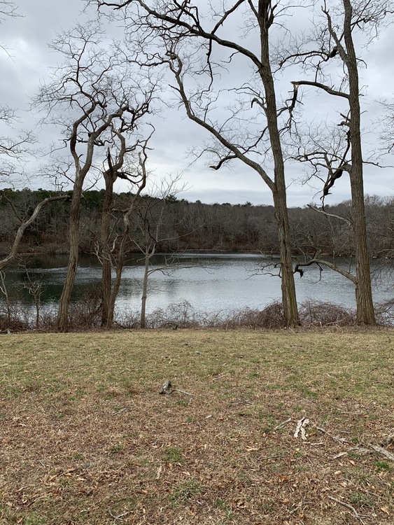
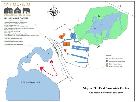
As you enter the gateway entrance to the Neck, follow the mowed path to the right to the pond viewing station. This beautiful piece of land has been referred to as ”The Neck” for as long as any locals can remember. It was a part of Benjamin Nye’s 1669 land grant, and has been in the family since.
The pond, known as Nye Pond, is spring fed. It produces a steady flow of cold water year-round. Prior to the construction of the Nye mill dam in the 1660s, the pond was much smaller and quite likely surrounded by swamp maples and cedars. An informal bottom survey conducted by a neighbor determined an average depth of 8 feet with the deepest point being 26 feet close to the center. These deep holes are where most of the spring flow emerges. This cold water made an ideal habitat for trout, both naturally occurring and those raised in the hatchery downstream.
Old County Road was very likely based on an ancient Native American footpath that headed down the Cape. It was the main road of its time. The passage over the Channel and across the Neck was a sensible choice that avoided the steep terrain south of the pond and the salt marsh inlet below. Though we are interested in the role settlers like Benjamin Nye played in the early English settlement that led to today’s world, we must pay tribute to the Native Americans for whom this must have been a very special place for thousands of years.
This concludes the walking tour. Please feel free to enjoy the property or head back to the visitors center to learn more! Thank you and have a nice day.